- By Todd Luck
- Posted Tuesday, August 25, 2020
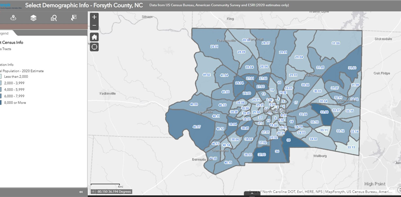
Interactive map provides easy access to census data
MapForsyth has an interactive Census Info Map that features the most commonly requested census data on population, race, ethnicity and income in Forsyth County.
It’s one of many interactive maps in the Map Gallery on MapForsyth’s website. The Census Info Map uses estimates for 2020 statistics. You can click on a Census Tract to see demographic information on it. Options located in the upper left of the map allow users to search for a tract using an address, choose layers to see different information, search by tract number, or select multiple tracts. You can click on the arrow at the bottom of the map to open an attribute table listing all or selected tracts with data that can be exported in a CSV file.
MapForsyth created the Census Info Map after receiving numerous requests from non-profits for census data they needed to fill out grant applications. The Census Info Map is a convenient way for anyone to access the local census data they need at any time.
Work with Us

Watch Our Monthly TV Show